More than 90% of the world breathes polluted air. Yet, many cities lack ground monitoring data needed to track air pollutants that impact public health.
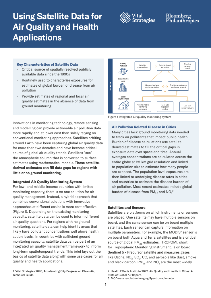
For countries with limited monitoring capacity, there is no one solution for air quality management. Instead, a hybrid approach that combines conventional solutions with innovative approaches at different scales is more cost effective. One approach includes the use of satellites and sensors. Satellites orbiting around Earth have been capturing global air quality data for more than two decades and have become critical source of global air quality trends. Satellites “see” the atmospheric column that is converted to surface estimates using mathematical models. These satellite derived estimates can fill data gaps and provide estimates of regional and local air quality in the absence of data from ground monitoring
This brief provides an overview on using satellite data for air quality and health applications, resources and trainings for cities to start integrating satellite data into their air quality management plans and national and access to regional datasets.
Recent Abstracts
Catalyzing Support for CRVS Improvement – Examples from the Data for Health Initiative
A Guide to Designing Contextualized Civil Registration and Vital Statistics E-Learning Courses
Guide to Developing Standard Operating Procedures (SOPs) for Civil Registration Using a Case-Based…
Building Safe and Healthy Communities
Uncovering the Hidden Risks of PM 2.5 Exposure Among School-Aged Children in Jakarta
Foundations & Futures: Reimagining Public Health in the Artificial Intelligence Era
Strengthening Health Systems to Address Air Pollution in Ethiopia
Policy Brief: Childhood Blood Lead Surveillance in Indonesia – Findings and Policy Recommendations
Impact of Blue Lanes on Road Safety: Crashes, Speed and Motorcyclists’ Perceptions in…
Impacto da Faixa Azul na Segurança Viária: Sinistros, velocidade e percepções de motociclistas…